Mapping Urban Growth in Bengaluru with Historical CORONA Imagery
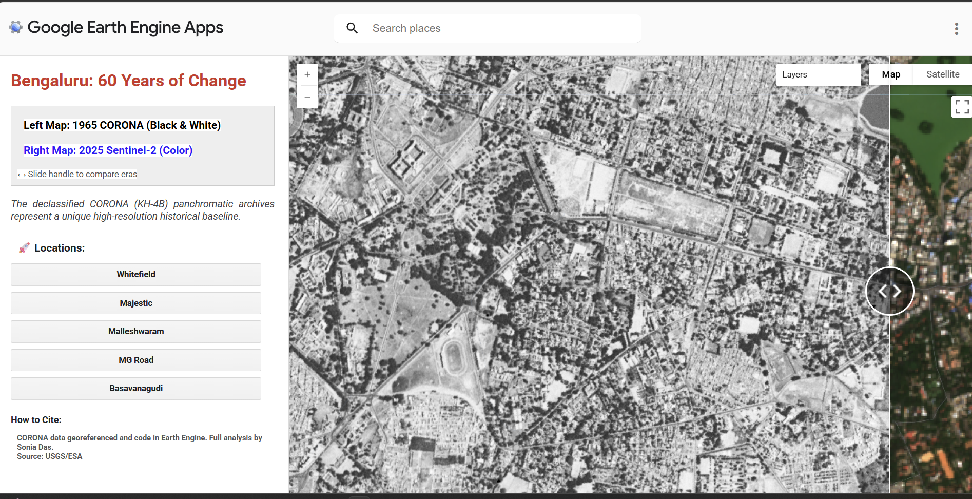
Overview
A Google Earth Engine web app that visualises high-resolution CORONA satellite imagery of Bengaluru from 1965 to study historical urban growth. Most studies of urban change use Landsat as their baseline, but CORONA's 2.75 m resolution pushes that baseline back further and reveals land-use changes that coarser imagery misses.
- Study Area: Bengaluru, India
- Duration: Ongoing personal project
- Role: Solo project
- Status: In progress
Methods & Tools
Data Sources
- Declassified CORONA satellite imagery (1965), 2.75 m resolution
- Landsat imagery, for baseline comparison
Processing Steps
- Georeferenced the historical CORONA imagery in QGIS
- Compared the georeferenced imagery against the standard Landsat baseline
- Published the imagery as an interactive web application on Google Earth Engine
Tools Used
| Tool | Purpose |
|---|---|
| QGIS | Georeferencing historical CORONA imagery |
| Google Earth Engine | Building and hosting the interactive web application |
Key Findings
- CORONA's 2.75 m resolution reveals land-use changes in 1960s Bengaluru that are not visible in the standard Landsat baseline
- Shifting the historical baseline back to 1965 gives a longer view of the city's urban growth trajectory
Links
Other Work Samples
- Walkability Analysis — Walkability scores for Bengaluru using NetAScore (University of Salzburg), which classifies OSM road networks for walkability and bikeability. Tools: QGIS, Python.