Map Gallery
Standalone maps and older work that do not have a full project write-up of their own. Some of it goes back to 2015, but it still shows the skills the newer work is built on.
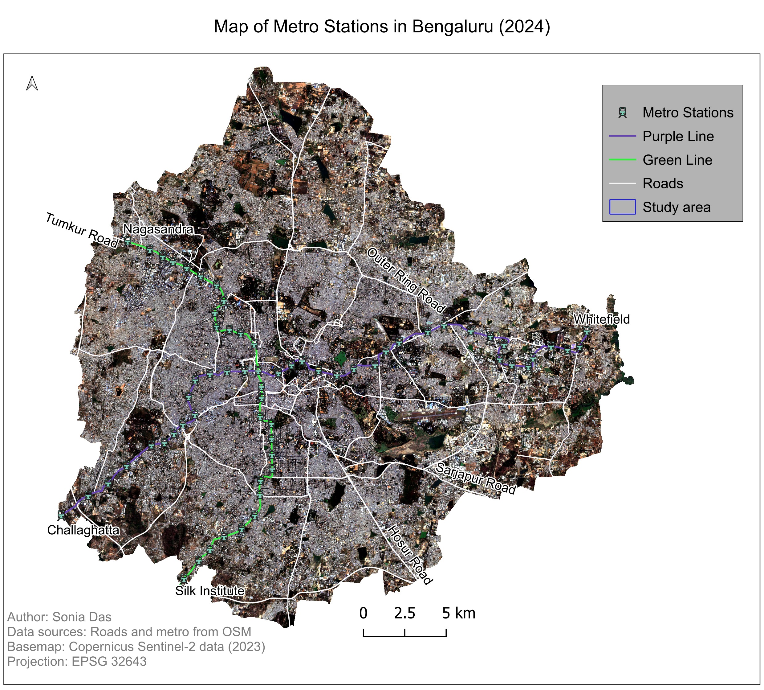
Metro Stations in Bengaluru
Purple and Green Line alignments and their stations mapped over a Copernicus Sentinel-2 basemap, with the arterial road network from OpenStreetMap.
QGIS Sentinel-2 OpenStreetMap
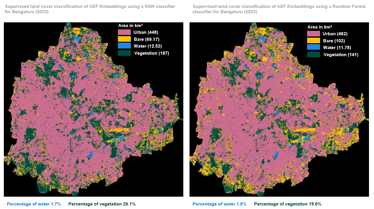
Land Cover from AlphaEarth Embeddings, Bengaluru 2023
KNN and Random Forest supervised classifications of AlphaEarth Foundations satellite embeddings, side by side. The two classifiers agree closely on water (1.7% vs 1.6%) but diverge on vegetation, at 26.1% against 19.6%.
Python Cloud Native Remote Sensing AlphaEarth Embeddings
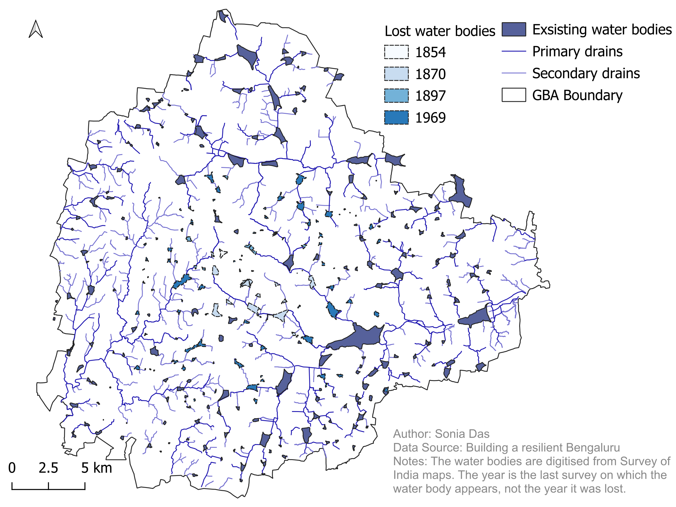
Lakes, Drains and Valleys of Bengaluru
Two companion maps. The first shows existing water bodies and those lost since the Survey of India maps of 1854, 1870, 1897 and 1969, with the primary and secondary drains. The second map places the stormwater drain network and lakes in the city's valleys over an SRTM elevation model.
QGIS Hydrology SRTM DEM